
 As global climate change intensifies and the marine economy continues to grow, traditional marine observation methods are no longer sufficient to meet the demands of modern oceanographic research, environmental protection, and marine resource management.
Why Do We Need to Understand the Ocean?
Covering approximately 71% of the Earth’s surface, the ocean plays a vital role in supporting life and regulating the global climate. However, much of the ocean remains poorly understood. To improve responses to typhoons, tsunamis, and other marine hazards, while supporting sustainable marine resource development, a comprehensive observation network capable of providing real-time, continuous, and wide-area data is essential.
What Is an Integrated 3D Marine Observation Network?
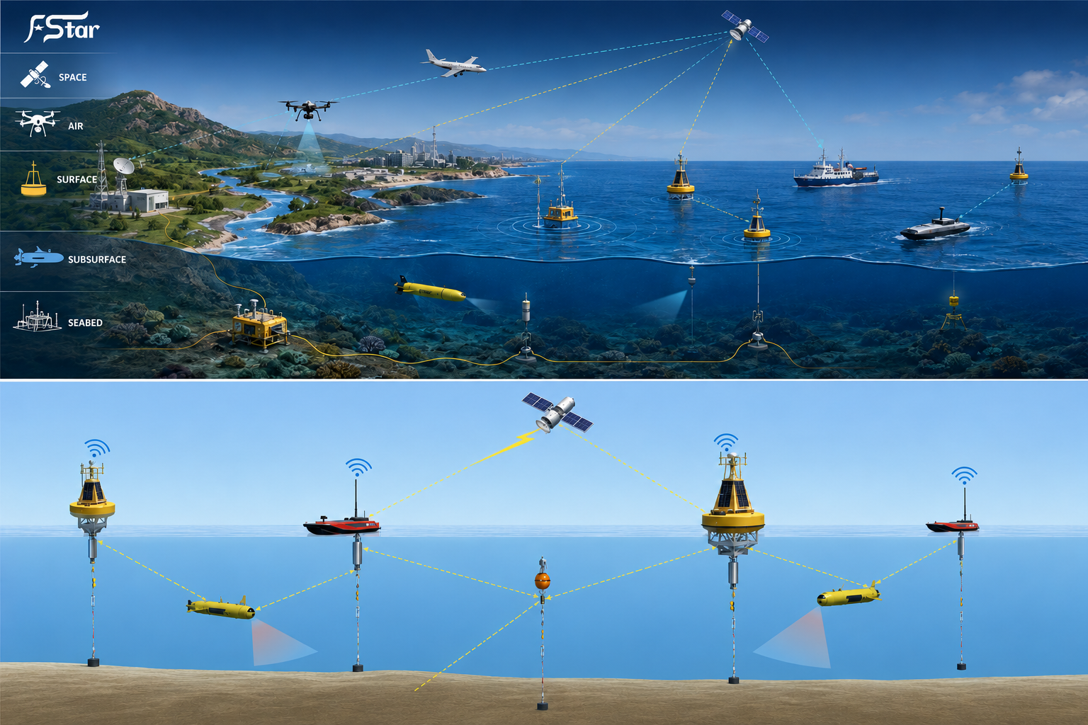
An Integrated 3D Marine Observation Network combines multiple observation platforms and technologies to achieve long-term, continuous, real-time, and multidimensional monitoring of marine environmental parameters.
Space-based platforms: satellites and remote sensing systems
Airborne platforms: UAVs and aircraft
Shore-based platforms: radar systems and coastal observation stations
Marine platforms: research vessels, drifting buoys, and moored buoys
Seafloor platforms: subsea cables and underwater sensor systems
Together, these technologies create a comprehensive Marine Observation System capable of monitoring marine environments from the atmosphere to the deep sea.
Key Observation Technologies
Satellites and UAVs provide wide-area and high-resolution observations of parameters such as sea surface temperature, ocean color, sea surface height, and wind fields. UAVs offer flexible deployment and can access areas that are difficult or dangerous for conventional platforms.
Major Applications
Integrated marine observation networks play an important role in marine disaster early warning, resource development, climate research, and ecological protection.
Future Trends
The future of marine observation will increasingly focus on Artificial Intelligence (AI), Internet of Things (IoT), and edge computing. AI can transform massive observation datasets into valuable insights, while low-power smart sensors and edge computing will enable faster and more efficient data processing.
Post time: Aug-13-2026