Radar Wave & Water Level Monitoring System – Non-Contact Water Level and Wave Monitoring

Radar Wave & Water Level Monitoring System – Non-Contact Water Level and Wave Monitoring,
non-contact radar water level sensor, radar hydrological monitoring system, radar water level measurement for flood warning, radar water level monitoring system for rivers, radar wave and water level monitoring system, radar wave monitoring for coastal applications, remote water level monitoring system,
Radar Wave & Water Level Monitoring Sensor
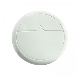
Frankstar Radar Wave & Water Level Monitoring Sensor is a high-precision, non-contact monitoring device specially developed for marine hydrological environments. Adopting 26GHz radar measurement technology, this radar wave sensor supports all-weather unattended real-time monitoring of wave height, wave period and water level. It works stably under severe meteorological and sea conditions, widely used for offshore wind farms, port waterways, marine engineering and coastal environmental monitoring. Supporting remote data transmission and platform integration, it delivers powerful data visualization and analysis functions to provide reliable hydrological data for marine safety management and oceanographic research.
Key Features
High-Precision Non-Contact Measurement
Adopts 26GHz linear sweep radar technology. Accuracy reaches ±3mm within 50m measuring range. No direct contact with seawater, no regular on-site calibration required, effectively avoiding corrosion and biological adhesion troubles.
All-Weather Stable Operation
IP67 protection grade, wide operating temperature range of -40°C ~ +70°C. Excellent resistance to water, corrosion and ice, adapting to high-humidity, salt-laden harsh marine environments.
Multi-Parameter Intelligent Output
Output up to 14 groups of wave and tidal parameters in real time, including significant wave height, spectral peak period, average water level, maximum wave height and other critical sea state data.
Plug-and-Play Easy Deployment
Highly integrated compact structure for simple installation. Supports solar power supply and DC power input, the ideal sensor solution for long-term unattended hydrological monitoring stations.
Technical Specifications
|
Radar Performance |
|
|
Measurement Range |
3 m – 80 m |
|
Accuracy |
±3mm (<50m); ±6mm (>50m) |
|
Beam Width |
≤4.5° |
|
Transmitting Frequency |
26GHz (linear sweep) |
|
Transmitting Power |
<0.5mW |
|
Measurement Frequency |
10Hz |
|
Output Frequency |
2–10Hz (default 4Hz) |
|
Electrical & Interface |
|
|
Supply Voltage |
8–32 VDC |
|
Power Consumption |
Average 0.4W, peak 1W; operating current <20mA |
|
Communication Interface |
RS485 (standard), USB, Ethernet (optional) |
|
Data Unit |
|
|
Storage Capacity |
SD card 32GB |
|
Power Supply for Data Unit |
24–48 VDC, 4.8W |
|
Environmental Performance |
|
|
Operating Temperature |
-40 °C ~ +70 °C |
|
Protection Class |
IP67 |
Application Scenarios
Frankstar Radar Wave & Water Level Monitoring Sensor is widely applied in offshore wind farm monitoring, port and waterway hydrological observation, coastal environmental monitoring, marine engineering survey, flood early warning systems and oceanographic scientific research. As a non-contact radar wave sensor, it avoids mechanical abrasion and marine organism attachment problems, delivering long-term stable wave height and water level data for shore-based platforms, observation towers and fixed monitoring stations.
Product Advantages
Different from inertial wave sensors deployed on buoys, this radar wave level sensor adopts shore fixed installation without floating platform support. The non-contact measuring mode reduces maintenance costs significantly. Low power consumption supports solar-powered off-grid monitoring stations. Multiple optional communication interfaces make it easy to connect with data loggers, cloud platforms and existing hydrological monitoring systems.
Accurate and continuous monitoring of water level and wave conditions is essential for hydrological management, flood warning, water-resource management, coastal observation, and marine engineering.
Traditional water-level measurement methods often require sensors to be installed in direct contact with water. While these systems can provide reliable measurements, installation and maintenance may become more difficult in environments with strong currents, floating debris, sediment, ice, or corrosive water.
A Radar Wave & Water Level Monitoring System provides a non-contact alternative.
The FrankStar Radar Wave & Water Level Monitoring System uses radar sensing technology to observe water-surface conditions without requiring the measurement sensor to be submerged. Depending on the system configuration, it can support monitoring of water level, wave conditions, surface velocity, and other water-surface information.
The system can be applied to rivers, reservoirs, canals, coastal areas, ports, flood-monitoring stations, and other locations requiring remote and continuous water observation.
What Is a Radar Water Level Monitoring System?
A Radar Water Level Monitoring System is a non-contact measurement system that uses electromagnetic radar signals to determine the distance between the sensor and the water surface.
The radar sensor is normally installed above the water surface.
It transmits a radar signal toward the water and receives the reflected signal. By analyzing the signal travel time or frequency characteristics, the system determines the distance between the sensor and the water surface.
If the installation elevation is known, the measured distance can be converted into water level.
The basic measurement process is:
Radar Transmission → Water-Surface Reflection → Signal Reception → Distance Calculation → Water-Level Calculation
Because the sensor does not need to contact the water, radar technology is particularly useful for challenging hydrological environments.
How Does Radar Water Level Measurement Work?
A radar-based water-level system generally consists of:
Radar sensor
Data acquisition unit
Communication system
Power supply
Monitoring or data platform
The radar sensor is installed above the monitoring point.
The sensor continuously or periodically transmits radar signals toward the water surface. The reflected signals are received and processed to determine the distance from the sensor to the water surface.
The water level can then be calculated according to the known reference elevation.
For example:
Reference Elevation – Measured Sensor-to-Water Distance = Water Level
The actual calculation method depends on the system configuration and installation reference.
Why Use Radar for Water Level Monitoring?
Radar provides several advantages for hydrological monitoring.
Non-Contact Measurement
The radar sensor does not need to be immersed in water.
This can reduce exposure to:
Sediment
Floating debris
Corrosive water
Biofouling
Strong currents
Ice
Mechanical damage
Low Maintenance
Because the sensing component is installed above the water surface, routine maintenance can be easier than with submerged sensors.
This is particularly useful for remote monitoring stations where frequent field visits are difficult.
Suitable for Difficult Environments
Radar water-level monitoring can be considered for environments where contact sensors may be difficult to install or maintain.
Potential locations include:
Fast-flowing rivers
Flood-prone channels
Bridges
Reservoirs
Coastal areas
Industrial waterways
Remote hydrological stations
What Can the FrankStar Radar Monitoring System Measure?
The FrankStar Radar Wave & Water Level Monitoring System can support multiple types of water-surface observation depending on system configuration.
Water Level
Water level is one of the core parameters for hydrological monitoring.
Continuous water-level data can support:
Flood monitoring
River management
Reservoir operation
Water-resource management
Hydrological research
Early warning systems
Wave Conditions
Radar technology can also be used for observing water-surface movement and wave conditions.
Wave monitoring can provide information useful for:
Coastal observation
Port management
Marine engineering
Offshore monitoring
Wave research
Environmental monitoring
Surface Velocity
Depending on the radar configuration, the system can also support observation of water-surface velocity.
Surface velocity information can complement conventional hydrological measurements and provide additional information about river or channel flow conditions.
Water-Surface Image and Video
For applications requiring visual confirmation, an integrated monitoring configuration may combine radar measurements with image or video observation.
This can provide both:
Quantitative Measurement + Visual Observation
Such an approach can be useful for remote monitoring and abnormal-condition verification.
Radar Water Level Monitoring for Flood Warning
Rapid changes in river water level are an important indicator of potential flooding.
A radar water-level station can continuously monitor changes in water level and transmit measurement data to a remote monitoring platform.
A typical flood-monitoring workflow is:
Radar Measurement → Data Acquisition → Remote Transmission → Water-Level Analysis → Threshold Detection → Warning
When the measured water level reaches predefined thresholds, the monitoring platform can be configured to generate alerts according to the requirements of the overall flood early-warning system.
Radar is particularly useful for flood monitoring because the sensor can remain above the water even when the river level changes significantly.
Radar Water Level Monitoring in Rivers
Rivers are one of the most important application areas for radar water-level monitoring.
A radar sensor can be installed on:
Bridges
Monitoring towers
Riverbanks
Hydraulic structures
Existing hydrological stations
Continuous measurements can support:
River-level monitoring
Flood observation
Discharge estimation
Hydrological forecasting
Water-resource management
When combined with an ADCP, water-level and water-velocity data can be collected together.
For example:
Radar Water Level + ADCP Flow Velocity + Rainfall Monitoring
can provide a more comprehensive picture of river hydrological conditions.
Radar Monitoring for Reservoirs and Lakes
Water level is an important management parameter for reservoirs and lakes.
Radar monitoring can provide continuous observations without requiring a submerged sensor.
Potential applications include:
Reservoir level monitoring
Water-resource management
Dam operation
Water-supply management
Drought monitoring
Long-term hydrological observation
Radar systems can also be integrated with telemetry equipment to support remote monitoring of reservoirs located far from populated areas.
Radar Wave Monitoring for Coastal and Marine Applications
Wave conditions are important for coastal engineering, ports, marine transportation, offshore operations, and environmental research.
A radar-based monitoring system can provide non-contact observation of the water surface without requiring a submerged wave sensor at the measurement point.
Potential applications include:
Coastal wave monitoring
Port observation
Harbor monitoring
Offshore engineering
Marine environmental monitoring
Coastal research
For marine applications, system configuration should be selected according to the required wave parameters, environmental conditions, installation location, and measurement objectives.