Disposable Lagrange Drifting Buoy (SVP Type) – Ocean Surface Current, Temperature and Salinity Monitoring
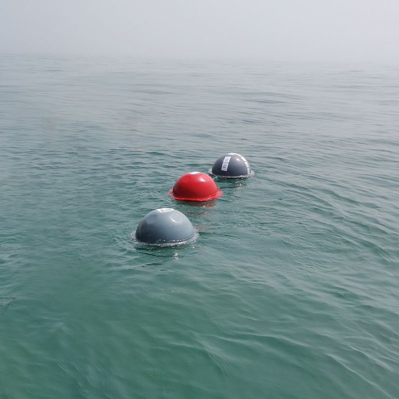

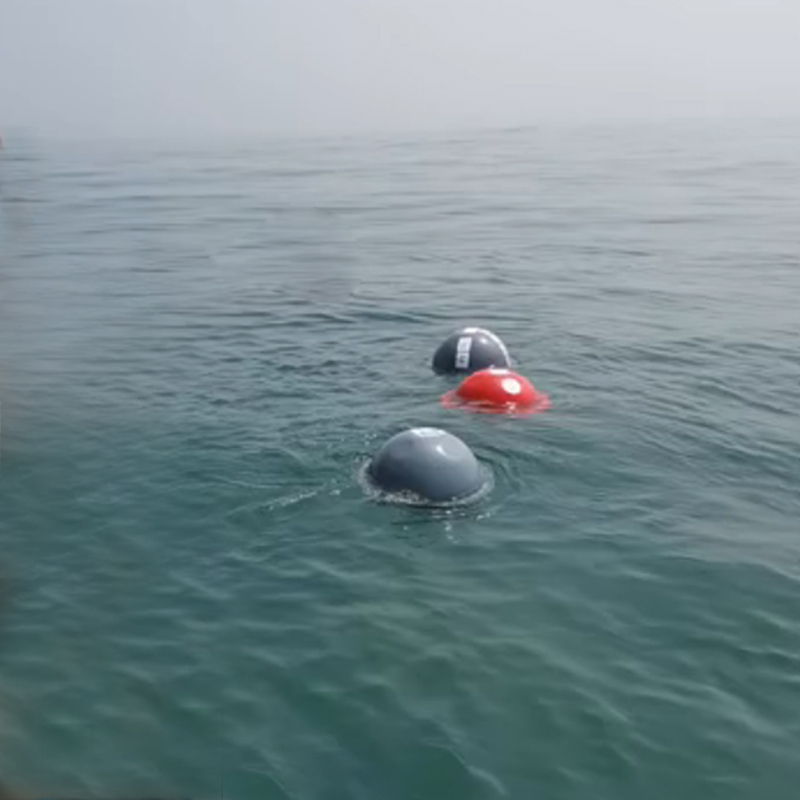

Disposable Lagrange Drifting Buoy (SVP Type) – Ocean Surface Current, Temperature and Salinity Monitoring,
disposable Lagrange drifting buoy for ocean current monitoring, disposable ocean drifter for marine research, drifting buoy for sea surface temperature and salinity, GPS ocean current drifter, Lagrangian drifter for surface current observation, SVP drifter for oceanographic observation, SVP drifting buoy with GPS,
Technical Parameters
| Iterm: | Index |
| Size | φ504mm |
| Meterail | High strength modified polycarbonate |
| Location via | GPS or Beidou |
| Transmission frequency. | Default 1 hour, tunable: 1 min~12 h |
| Temp Sensor | Range:-10~50℃, accuracy:0.1℃ |
| Data transmission | Default Iridium(multiple options: Beidou/Tiantong/4G) |
| Set and testing mode | Remote |
| Sail wideth | φ90 cm, H:4.4m |
| Sail depth | 1~20m |
| Net weight |
12Kg |
| Drift trace | Auto |
| On/off mode | Single contact Magne-switch |
| Work Temp | 0℃-50℃ |
| Storage Temp | -20℃-60℃ |
Ocean surface currents continuously transport heat, salt, nutrients, pollutants, and floating materials across the marine environment. Understanding how these currents move is therefore essential for oceanographic research, marine environmental monitoring, weather and climate studies, and ocean circulation modeling.
Unlike a fixed ocean monitoring station, a Lagrangian drifting buoy moves with the surrounding water. By tracking the buoy’s geographic position over time, researchers can estimate the movement of the water mass in which the buoy is drifting.
The FrankStar Disposable Lagrange Drifting Buoy (SVP Type) is designed for observing ocean and sea-surface current, temperature, and salinity, while recording the buoy’s GPS location.
Its disposable design makes it suitable for observation missions where the buoy is deployed for a defined period and does not need to be recovered after completing its measurement task.
What Is a Lagrangian Drifting Buoy?
A Lagrangian drifting buoy, or ocean drifter, is a free-drifting observation platform that follows the movement of the surrounding ocean.
There are two common approaches to studying ocean movement:
Eulerian Observation
An Eulerian observation system remains at a fixed geographic location and measures how ocean conditions change over time.
Examples include:
Fixed buoys
Mooring systems
Coastal monitoring stations
Lagrangian Observation
A Lagrangian platform moves with the water and records observations along its trajectory.
Examples include:
Ocean drifters
SVP drifters
Drifting data buoys
The key difference is:
Eulerian = Observe changes at a fixed location
Lagrangian = Observe changes while moving with the water
A Lagrangian drifter therefore provides valuable information about the movement and characteristics of the water mass itself.
What Is an SVP Drifter?
SVP commonly refers to a Surface Velocity Program drifter design used for observing near-surface ocean circulation.
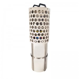
An SVP-type drifter typically consists of a surface float and a subsurface drogue or equivalent drag element designed to couple the drifter’s movement more closely with the surrounding ocean current at the target observation depth.
This helps reduce the influence of direct wind-driven movement on the surface float and allows the trajectory to better represent the movement of the targeted water layer.
The specific design and deployment depth depend on the product configuration and project requirements.
How Does a Lagrangian Drifting Buoy Work?
The basic observation process can be summarized as:
Deployment → Drifting with Ocean Current → Sensor Measurement → GPS Positioning → Data Transmission/Storage → Trajectory Analysis
After deployment, the buoy moves through the ocean.
At predefined sampling intervals, onboard sensors collect environmental measurements such as:
Surface current-related movement
Sea surface temperature
Salinity
GPS position
The position of the buoy is recorded together with the corresponding measurement data.
Over time, the sequence of GPS positions creates a drift trajectory.
Researchers can then analyze the trajectory to study surface circulation and water-mass movement.
What Does the Disposable Lagrange Drifting Buoy Measure?
The FrankStar SVP-type drifting buoy is designed around several key oceanographic observations.
1. Ocean Surface Current
The buoy’s movement provides information about the horizontal movement of the surrounding water.
By comparing GPS positions over time, researchers can calculate the buoy’s displacement and derive information related to surface current movement.
A simplified concept is:
Current Velocity = Change in Position ÷ Change in Time
The resulting trajectory can reveal:
Current direction
Current movement
Drift speed
Spatial circulation patterns
The calculated current should be interpreted as representative of the drifter’s target water layer and deployment conditions.
2. Sea Surface Temperature
Sea surface temperature (SST) is a fundamental oceanographic parameter.
Temperature observations along the drifter’s trajectory can help researchers study:
Ocean temperature distribution
Water-mass movement
Ocean-atmosphere interaction
Seasonal variability
Marine environmental conditions
Because the buoy moves through different locations, it can provide temperature observations across a broader geographic area than a single fixed station.
3. Salinity
Salinity is another important parameter for understanding ocean circulation.
Salinity measurements can help identify:
Different water masses
Freshwater influence
Mixing processes
Ocean circulation patterns
Changes in marine environmental conditions
Combining temperature + salinity + location provides significantly more information than observing any single parameter independently.
4. GPS Location
GPS positioning is fundamental to a Lagrangian drifter.
Each observation can be associated with a geographic location and time.
This allows researchers to reconstruct the complete drift trajectory:
GPS Position 1 → GPS Position 2 → GPS Position 3 → GPS Position 4 → …
The resulting trajectory can be plotted on a map and analyzed alongside oceanographic measurements.
Why Combine Current, Temperature, Salinity and GPS?
The greatest value of a drifting buoy comes from combining multiple datasets.
For example:
GPS Location + Time + Temperature + Salinity + Drift Movement
can help researchers determine:
Where the water mass moved
How quickly it moved
How temperature changed along the trajectory
How salinity changed along the trajectory
Where different water masses may interact
How ocean conditions vary geographically
This creates a multidimensional dataset for oceanographic analysis.
Applications of Disposable Lagrange Drifting Buoys
1. Ocean Current Research
One of the main applications is observing surface ocean circulation.
Multiple drifters can be deployed across an observation area to obtain a broader view of current movement.
This can support research into:
Surface circulation
Ocean gyres
Coastal currents
Mesoscale circulation
Water-mass transport
2. Oceanographic Surveys
Lagrangian drifters can complement ship-based and fixed-station observations.
Instead of collecting data only along a predetermined ship route or at fixed stations, drifters provide observations along naturally evolving trajectories.
This makes them useful for large-area oceanographic campaigns.
3. Sea Surface Temperature Monitoring
Drifters can provide in-situ SST observations that complement satellite-based temperature observations.
In-situ observations can be useful for:
Satellite data validation
Ocean temperature research
Climate studies
Marine environmental monitoring
4. Salinity Distribution Studies
Drifting salinity observations can help researchers understand how salinity changes across ocean regions.
Potential research areas include:
Freshwater transport
River plume studies
Coastal mixing
Water-mass identification
Ocean circulation
5. Ocean Model Validation
Numerical ocean models require observational data for validation and performance assessment.
Drifter trajectories provide useful information about surface circulation.
Temperature and salinity measurements can provide additional observations for comparison with model outputs.
A typical research workflow is:
Drifter Data → Quality Control → Trajectory Analysis → Model Comparison → Ocean Circulation Assessment
6. Marine Pollution and Drift Studies
Floating materials can be transported by ocean currents.
Drifter trajectories can therefore support research into the movement of:
Floating debris
Marine pollutants
Oil-related transport
Biological material
Other surface-drifting objects
The drifter acts as an observation platform for understanding transport patterns rather than directly measuring every pollutant itself.
7. Coastal Current Observation
Coastal waters often experience complex circulation caused by tides, winds, freshwater input, coastline geometry, and other factors.
Lagrangian drifters can be deployed to investigate how water moves through coastal regions.
Potential applications include:
Coastal current studies
Estuary research
River plume monitoring
Coastal environmental assessment
Marine ecosystem research